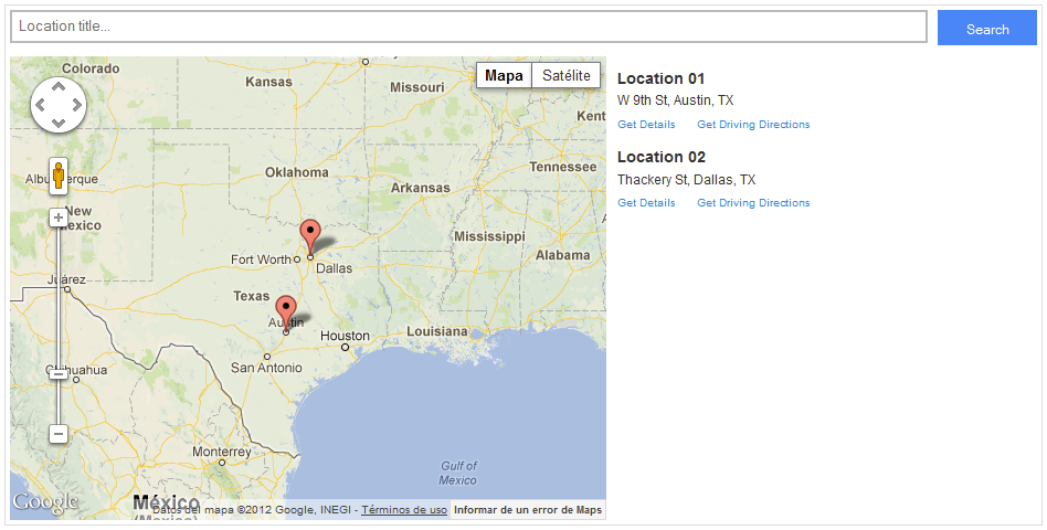
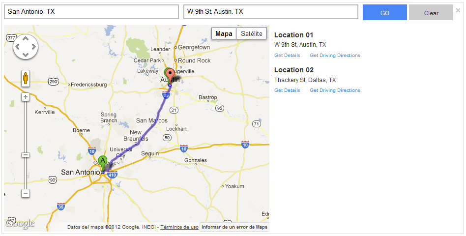
A lightning & powerful jQuery plugin with HTML 5 that makes Google Maps v3 easy by sending a simple JSON Data Structure.
vMap not only displays the location markers in the map, but also displays a list with the locations, this list offers some extra features, for example: A location can be clicked and it will be highlighted in the map.
Copyright (c) 2012 Victor Hugo Garcia - [email protected]
To get started, download the plugin, unzip it and copy files to your website/application directory. Load files in the section of your HTML document. Make sure you also add the jQuery library.
<head>
	<script src="http://maps.googleapis.com/maps/api/js?key=abcdef&sensor=true" type="text/javascript"></script>
    <script type="text/javascript" src="https://ajax.googleapis.com/ajax/libs/jquery/1.8.3/jquery.min.js"></script>
    <link rel="stylesheet" href="/jquery.vmap.css" type="text/css"/>
    <script type="text/javascript" src="/jquery.vmap.js"></script>
</head>
Note, you should change key parameter for the one given by Google.
Add the follow HTML to your page under body tag (section tag is optional):
<section>
<div class="vmap">
<div class="row">
<!-- Search Content -->
<div id="map_search" class="vmap-search">
<input id="address" class="vmap-address input-control" type="text" placeholder="Location title..." />
<input id="search" class="button bg-color-blue" type="button" value="Search" />
</div>
<div id="map_directions" class="vmap-directions square">
<input id="origin" type="text" placeholder="Origin" class="vmap-origin input-control" value="" />
<input id="destination" type="text" placeholder="Destination" class="vmap-destination input-control" />
<input id="route" class="button bg-color-blue" type="button" value="GO" />
<input id="clear" class="button" type="button" value="Clear" />
<a id="close" class="close" href="#">×</a>
</div>
</div>
<div class="row">
<!--Map content-->
<div id="map_canvas" class="vmap-canvas pull-left">
</div>
<!--Sidebar content-->
<div id="map_list" class="vmap-list pull-right">
</div>
<div class="clearfix"></div>
</div>
</div>
</section>
Initialize the script like this:
<script>
    $(document).ready(function() {
        $('#map_canvas').vmap({url:"/webservice/get_locations"});
    });
</script>
It can aslo be passed optional options objects which will extend the default values. Example:
<script>
    $(document).ready(function() {
        $('#map_canvas').vmap({
			url: "/webservice/get_locations",
			data: "{'address':'known'}",
			initLatitude: "31.74",
			initLongitude: "-95.42",
			initZoom: 4,
			classAddress: "street",
			classTitle: "title"
        });
    });
</script>
Note, ajax requests are subject to the same origin policy.
| Key | Default Value | Description | Mandatory? |
|---|---|---|---|
| url | Empty String | A string containing the URL to which the request is sent. | Yes |
| data | Empty String | Data to be sent to the server on the Url specified. | No |
| initLatitude | 31.74 | Latitude where the map will be centered initially. | No |
| initLongitude | -95.42 | Longitude where the map will be centered initially. | No |
| initZoom | 4 | Initial zoom of the map (integer). | No |
| classAddress | 'address' | Assign a class to the tag where the location address is displayed. | No |
| classTitle | 'title' | Assign a class to the tag where the location title is displayed. | No |
| classPageLink | 'page-link' | Assign a class to the location page link tag. | No |
| classDirectionsLink | 'directions-link' | Assign a class to the location direction link tag. | No |
| showDirectionsLink | false | Hide or show the driving directions links under each location. | No |
| showPageLink | false | Hide or show the location page link under each location. | No |
| showList | false | Hide or show the list of locations. | No |
| showSearch | false | Hide or show the search bar. | No |
The data must be returned in strict JSON format, below is a sample of the structure:
{
"items": [{
			"Title": "Location Name 01",
			"Link": "/to-some-where.aspx",
			"Latitude": "72.372055",
			"Longitude": "-19.7305979",
			"Address": "1900 Test Road, State, Country, ZipCode"
		}, {
			"Title": "Location Name 02",
			"Link": "/any-where.aspx",
			"Latitude": "72.372055",
			"Longitude": "-19.747201",
			"Address": "1900 Test Road, State, Country, ZipCode"
		}
		]
}
Chrome, Safari 6+, Firefox, IE 7+, Opera 12+
vMap licensed under Creative Commons Attribution-NonCommercial 3.0 license. You are free to use vMap for your personal or non-profit website projects. You can get the author's permission to use vMap for commercial websites.
Have a bug? Please create an issue on GitHub at https://github.com/vhugogarcia/vMap/issues

